Unleash the power of machine data to understand what is happening in the world around us - in real time - and change it for the better.

Book a Demo
Demo Video
2 minute video

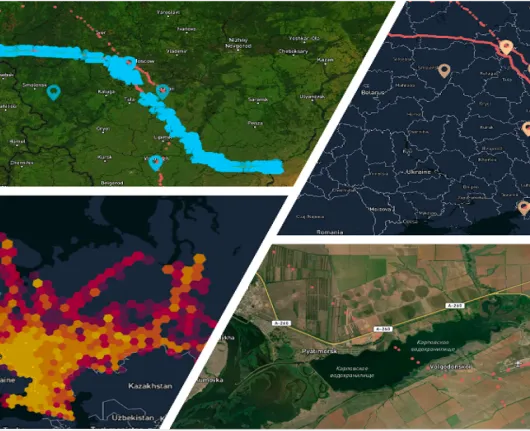
Extract critical insights at speed to enable faster and more accurate decision making from the constant flow of real-time data generated by sensors, mobile devices, cameras, vehicles and other IoT platforms moving in time and space.

Machine data is growing faster than we can manage

As the volume, velocity and variety of data continues to grow exponentially, it becomes increasingly challenging, complex and costly to ingest, process and analyze hyper-scale data. Queries become impractical and prevent users from deriving timely information or intelligence.

Domains

Air

Land

Sea

Space

Cyber

Finance

The Solution

A high-performance, scalable data infrastructure platform that is purpose-built and designed for fast and effective analysis of spatiotemporal (location and time) data.

Ingest, index, query and alert across large and diverse data sets at millions of records per second on batch or streaming data to support critical decisions.

Interrogate and Uncover

Plus sign

Routes

Plus sign

Devices of interest

Plus sign

Locations of Interest

Plus sign

Patterns of behavior

Plus sign

Co-travelers

Plus sign

Common dwelling and meeting points

Customers tell us

“We are overwhelmed with data and can neither extract intelligence nor query the data fast enough for actionable insights”

Intelligence Analyst

“We are unable to ingest spatiotemporal sources at scale - let alone analyze the data” Data Scientist

Data Scientist

“Everyone has a visualization tool but no-one has your engine and processing power”

Government Technical Lead

“1.5 billion records used to take us 12 hours to ingest using traditional PostGIS processing and 12 hours more to index. The entire data set is now ingested and indexed in just 4 minutes and 43 seconds. That is game changing”

Government Analyst

Technical Overview

Based on a highly optimized database kernel containing multiple technologies and unique architectural features, the platform provides an unparalleled foundation and scalable solution for processing high velocity, high volume spatiotemporal workloads - streamed or in batches.

State-of-the-art, thread-per-core architecture, vectorized storage model and user space scheduling of I/O and execution combine with the ability to ingest and simultaneously index streaming workloads. This allows analysts to create immediately queryable datasets and run complex, spatiotemporal queries in seconds, instead of minutes, hours or days.

Real time machine data.
Real world possibilities.

Benefits

Complementary

Fits seamlessly into existing infrastructure, aggregating data from multiple sources

Fast

Index on ingestion at millions of spatiotemporal records per second

Instant intelligence

Run complex polygon relationship and geofencing queries during live ingest

Macro to micro visualization

Drill down from billions of data points to pinpoint entity-level detail in seconds

Smart

Layer historic and streaming spatiotemporal data in different formats to create rich data models at massive scale

Increase productivity

Free up analysts for other important tasks

Scalable

Store hundreds of billions of records per index on a single General System instance

Energy efficient and low cost

Small footprint keeps costs low and contributes to ESG goals

By clicking “Accept All Cookies”, you agree to the storing of cookies on your device to enhance site navigation, analyze site usage, and assist in our marketing efforts. View our Privacy Policy for more information.